Meandering river Study guides, Class notes & Summaries
Looking for the best study guides, study notes and summaries about Meandering river? On this page you'll find 64 study documents about Meandering river.
All 64 results
Sort by
-
Science Olympiad - Dynamic Planet Latest Update Graded A+
- Exam (elaborations) • 22 pages • 2024
- $9.99
- + learn more
Science Olympiad - Dynamic Planet Latest Update Graded A+ USGS topographic maps detailed record of a land area, giving geographic positions and elevations for both natural and man-made features. They show the shape of the land the mountains, valleys, and plains by means of brown contour lines stream order The concept that describes the hierarchy of stream types (see image) Perennial streams Water flows in the stream at least 90 percent of the time in a well defined channel. Int...
-
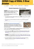
GIZMO Copy of KWAL 5 River Erosion
- Exam (elaborations) • 7 pages • 2021
- $8.99
- 11x sold
- + learn more
Exam (elaborations) GIZMO Copy of KWAL 5 River Erosion Student Exploration: River Erosion Vocabulary: cutbank, discharge, erosion, flood, floodplain, meander, meandering river, oxbow lake, point bar, river speed, sediments, slope, streambank, streambed, tributary, weathering Prior Knowledge Questions (Do these BEFORE using the Gizmo.) 1. The image above shows a raging mountain river in full flood. What do you think is making the water brown in color? Dirt 2. What impact do you think t...

-
Science Olympiad - Dynamic Planet Exam Study Guide
- Exam (elaborations) • 10 pages • 2024
- $12.49
- + learn more
Science Olympiad - Dynamic Planet Exam Study Guide USGS topographic maps - answerdetailed record of a land area, giving geographic positions and elevations for both natural and man-made features. They show the shape of the land the mountains, valleys, and plains by means of brown contour lines stream order - answerThe concept that describes the hierarchy of stream types (see image) Perennial streams - answerWater flows in the stream at least 90 percent of the time in a well defined channe...

-
Arkansas History Chapter 1 Questions and Answers Already Graded A
- Exam (elaborations) • 6 pages • 2024
- $8.99
- + learn more
Arkansas History Chapter 1 Questions and Answers Already Graded A Name 2 different kinds of rivers Rolling River, Meandering River In what ways are rivers some of our most valuable natural resources Crops, Transportation Name 3 major rivers that flow through Arkansas and 1 detail 1. Arkansas River- longest river 2. Mississippi River- Borders Arkansas 3. Buffalo River- declared 1st national river in 1972 What are oxbow lakes and how are they formed? Oxbow lakes - a horseshoe shape lake . They ...

-
GY Learn Smart Study Exam Questions 2024.
- Exam (elaborations) • 7 pages • 2024
- $9.99
- + learn more
GY Learn Smart Study Exam Questions 2024. What is the name of the subsidiary channels that join up with the main river channel? - CORRECT ANSWER Tributaries The type of sediment transport that involves a series of leaps or bounces off the bottom of a steamed is ___. - CORRECT ANSWER saltation Match the condition on the left with the effect on the river or drainage system on the right. - CORRECT ANSWER Dam: Changes the base level because of sediment buildup Tectonism: Can increase the...


-
UIUC NRES 100 -Exam 2 Questions With Verified Answers
- Exam (elaborations) • 16 pages • 2023
- $10.99
- + learn more
Wetlands - Answer Can be drained for agriculture or development. Text: landforms such as salt marshes, swamps, bogs, prairie potholes, and vernal pools. adaptive management - Answer is necessary for restoration to succeed.(2) the application of science to the management process. reclamation - Answer restoring land degraded by mining restoration ecology - Answer depends on science to discover what used to be, what is possible, what an ecosystem or species requires to persist, and how d...

-
Geol 310T Exam 1 Latest 2023 Rated A+
- Exam (elaborations) • 6 pages • 2023
- $8.99
- + learn more
Geol 310T Exam 1 Latest 2023 Rated A+ Number of national parks 59 Number of national monuments 79 first national park Yellowstone Granite characteristics -big crystals -interlocking Tuff -fine graned w/other pieces of rocks Granite Color white, pink, black, gray Tuff color white, tan, light gray limestone forms from carbonate material 3 metamorphic rocks Gneiss, marble, schist granite turns to gneiss limestone turns to marble shale turns to schist metamorphic formation recombine elem...

-
UCA Earth Systems Science Final (flatley)
- Exam (elaborations) • 13 pages • 2024
- $11.99
- + learn more
Moving from the earth's crust towards the earth's core, temperature _____________ and pressure _______________. - increases; increases Large crystal size is associated with what type of rock? - Intrusive igneous Rocks found within the core of a mountain range formed along a continental-continental convergent plate boundary are likely to be: - Metamorphic processes associated with a mid-ocean ridge - Mantle convection Plate divergence Crustal formation When oceanic crust collides ...

-
Landscapes - Earth Science fully solved graded A+ 2023/2024 passed
- Exam (elaborations) • 2 pages • 2023
- $9.99
- + learn more
Landscapes - Earth Science Landscape - correct answer The shape of land surfaces Landscape type #1 - correct answer Mountains → High elevation, NOT flat, deformed/metamorphic/igneous rocks Landscape type #2 - correct answer Plains → low elevation + flat rocks (usually sedimentary) Landscape type #3 - correct answer Plateaus → high elevation + flat rocks inside Arid climate (DRY) topography - correct answer angular/stair-step Humid climate - correct answer more soil&vegetation- more r...
-
River Erosion Gizmo Latest Update Graded A
- Exam (elaborations) • 2 pages • 2023
- $7.99
- + learn more
River Erosion Gizmo Latest Update Graded A V Letter that describes the shape of a typical mountain valley Tributary A stream or river that flows into a larger river Waterfall A place in a stream where water falls straight down Stream bank The side of a stream Stream bed The bottom of a stream Slope How steep a channel is River speed The measure of how fast water flows Discharge The water volume that flows past a given point each second Meandering rivers Have wide flat bottoms and are fou...
